Wednesday, April 30, 2014

Back to Biking--to Illinois!

Today I cycled 60 miles with 3,363 feet of climbing, for 6.75 hours on the road. The day started out sunny but became cloudy and quite cool due to the brisk wind. The temperature was in the mid 50s. 


Gorgeous day! The road surface was good, and there was almost no traffic (which was good because the roads had no shoulders and dropped off steeply). 

It was a good dog day. Yes, there were a number of loose dogs, but I either got the jump on them or they were friendly or indifferent. 

I did not get lost today! That improves my mood, no doubt. The riders who did take an unplanned detour ended up in the thick of a pack of dogs, and then had to pass by them again to get back on route. 

We had the Ohio River on our left most of the day. All the recent rain will end up feeding into the Ohio; flooding is expected in another day or two. 


The following shot is my failed attempt to show you the one super-steep hill that I walked today. This part at the top is not all that steep, but maybe you can tell that it drops dramatically around that corner (complete with a long, S-shaped curve) and that the Ohio River in the distance is a lot lower in elevation. 


We crossed a number of tributaries...


Can you see the Ohio beyond this pastureland?


At the end of our route, we took a ferry across the Ohio River to Cave-in-Rock, Illinois. The small, free ferry runs every 15 minutes or so. 


The ferry approached at quite a severe angle and, at the last second, docked perfectly on the tiny ramp. You could tell these guys have been doing this a long time. 


The view upriver from the ferry. 


A number of us stopped at Rosie's Country Kitchen in Cave-in-Rock to warm up and eat. 


After setting up camp (at Cave-in-Rock State Park) and showering, Nora and I walked to the cave. I was not expecting something so big!

Here is the approach:


The cave entrance (with Nora for scale). Notice the graffiti on the ceiling. 


Inside the cave, there is a fissure that lets in light. 


Looking back toward the entrance...


Walking back to camp from the cave, we saw the ferry crossing the river again. 


Today's route, part 1:


Part 2:


Part 3:


Tonight is our only night in Illinois. We will use the ferry to cross back over the Ohio River tomorrow morning and pick up our route through Kentucky. 

Tuesday, April 29, 2014

Land Between the Lakes National Recreation Area

The Tennessee and Cumberland Rivers were dammed to create the Kentucky and Barkley Lakes. The strip of land between the lakes was designated by JFK in 1963 as a national recreation area,  with the intent that the LBL would demonstrate how to improve recreation, environmental education, resource management, and restoration. 

We saw bison and turkeys along with beautiful views of pastures and water. Sorry no photos; we were moving too fast. 


One of our resident bird watchers in action:


Note: At the Visitor Center, I picked up a road map of Kentucky--to hedge my bets against future off-route miles. 

Fort Donelson National Battlefield, Dover, TN

Forts Henry, Heiman, and Donelson were located at key sites along the Tennessee and Cumberland Rivers. During the 1800s, the rivers were the superhighways for moving supplies. In 1862, the Union wanted to capture these forts in order to control these shipping lanes and also to break the Confederates' line of defense, which would give the Union Army access to the South.

Fort Henry quickly fell when Union gunboats bombarded it. Fort Heiman, intended to reinforce Fort Henry, wasn't yet completed, so the Confederates quickly abandoned it. 

Fort Donelson posed more of a challenge. It was well defended with both heavy guns controlling the Cumberland River, and troops and reinforcements defending an outer defense line. Still, Union forces moved to surround the fort. A winter blizzard quickly made conditions miserable. The Confederates, hoping to avoid starvation, attacked Union troops on one end of the line in order to escape to Nashville. Just as the Confederates were advancing and nearly free and clear, a poor command decision ordered them back to the fort. Union troops moved back in to surround the fort and demanded that Southern troops surrender. Ulysses S. Grant would not accept any terms other than unconditional surrender, earning him the name "Unconditional Surrender" Grant. The two top Confederate generals fled the scene by river, leaving General Buckner to surrender to Grant.


The defeat of Fort Donelson opened a door to the South for the Union Army. 13,000 Confederate soldiers were shipped north by river to prisoner of war camps. Many were exchanged for Union prisoners later that year. Grant was promoted to major general after this victory. Grant refused to return escaped slaves to their owners, so freedmen camps were established behind Union lines. 300 slaves wintered at Fort Donelson in 1864.

Fort Donelson by the numbers--North and South:


The former Dover Hotel where General Grant accepted General Buckner's unconditional surrender:


Leaping Ahead to Kentucky (Day 17)

We woke up to a respite from the rain. Only a respite, though; more rain and wind followed later in the day. 

Here's our morning double rainbow:


Sitting around yesterday, riding out the weather, seemed very odd. Most of us went a bit stir crazy. If we had started pedaling again today in Waverly, we would have been a day behind schedule and we would still be caught in potentially severe weather. 

After weighing our options, the group decided to jump ahead two days in our route. Our gamble is that this will 1) put us a day ahead of schedule (potentially allowing us to turn two upcoming back-to-back, 70-something-mile days into three more reasonable days), and 2) move us far enough north to move us out of the worst of the severe-weather zone. 

We were able to leap ahead with all of our gear, bikes, and people at once. Here is the trailer fully loaded with personal and group gear:


Here is the van as the last bike is being loaded on top:


and the last people loading in the van:


We drove the route we would have cycled. It was pretty and very hilly. Some of the road surfaces were so chewed up and eroded, I cannot imagine having to cycle over them!

We made some sightseeing stops along the way--see separate posts. 

We set up camp--at Canal Campground in Grand Rivers, KY--in pouring rain. It's a challenge to keep a tent dry while setting it up in pouring rain. I got mine set up dry and then helped others. 

We have camped along a lot of water during this trip, but this is the first place that has had a real swimming area. So far, though, it feels too cold and rainy to swim!


Monday, April 28, 2014

Unexpected Rest Day

It has been pouring rain, complete with thunder and lightning, all morning. The forecast is for worse as the day continues. The trip leaders decided to keep us at the motel for another day. I lucked out; I could use the day of rest and away from the vibration of riding.

Until now, I haven't had much time or energy for reading. I'm making up for it today. I'm reading stories from The Underground Railroad: Authentic Narratives and First-Hand Accounts by William Still. I read a story about a plan to free an enslaved wife and children in Alabama, in order to reunite them with a man who had purchased his own freedom and was now living in the North. The plan was that Seth Concklin would meet up with the woman and children--using a cape given to him by the husband to use as a signal that he was someone who could be trusted. They would use a skiff to travel the Tennessee River and the Ohio and Wabash Rivers before heading overland. Sitting here today, close by the Tennessee River, in these weather conditions, I'm stunned by the courage it took to attempt these escapes. 

The escape--from Alabama to Indiana-- went mostly as planned, with the escaping slaves often lying in the bottom of the skiff covered with blankets. At one point, Concklin ignored voices (and gunshots) hailing him from shore by acting like he didn't hear anything. 

Unfortunately, the slaves were recaptured in Indiana, and Concklin was imprisoned. (This was 1851 and the Fugitive Slave Act of 1850 meant that escaped slaves were not safe from recapture, even after they made it to the North.) Concklin made some kind of escape at some point but was later found "drowned, with his hands and feet in chains and his skull fractured." Most escapes were unsuccessful, and people paid a high price in pursuit of liberty. 

Sunday, April 27, 2014

Lost in the Hail

Today I cycled 61 miles, climbed 4,180 feet, and was on the road for 6.5 hours. This was not a good day to get lost--it was challenging enough without that--but I managed to get lost anyway. (I should have cycled 56 miles and not cycled over an extra mountain,)

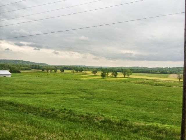
I thought the countryside today was some of the prettiest we've seen yet. Steep hills! So steep that I got off my bike and walked three sections. Another one of our riders refers to this as the "walk of shame." I prefer to think of it as "saving my knees for another hill/day."

I must have seen 15 cardinals today. Thought of my mother every time; she especially loved cardinals.

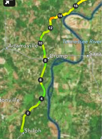
The route was tough to follow today because there were many consecutive turns that were described, for example, as "turn on unsigned Crooked Creek Rd." When there are no road signs, the only thing that gives you a clue is the number of miles you've gone since your last known location. I was obsessively checking my odometer but still managed to miss a turn. When I came upon a left turn, I could tell it was not the turn I was looking for. By then, I knew I had gone too far, but I wasn't sure that back-tracking was my best option. (If I didn't see the turn my first time by, would I see it going by again?)

I tried using Google Maps to find my location, but I didn't have enough signal. So there I was, in backwoods Tennessee, on a deserted road, with two dogs barking and leaping at me (of course), off the route map, with no clue where I was. I got lucky because a woman in a pickup came along and allowed me to flag her down. I told her all kinds of road and town names from our route, but only one rang a bell with her. She told me that, if I followed the road to the left, it would come out on Crooked Creek Rd. What she neglected to say was that the road went up over a mountain. 

After climbing and descending the mountain, I did come to a road--with no street sign. I assumed it was Crooked Creek Rd, but I wasn't sure where along the road I was, so I did not know if I should turn left or right in order to get back on route. Luckily, I had cell signal here. Google Maps initially showed my location without a single street name--not very helpful. As I stood there pondering what to do, I realized that street names were starting to fill in on the map. Eventually, I was able to figure out that I should turn left. A few miles later, I was back on route, but well behind the entire rest of our group. 

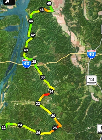
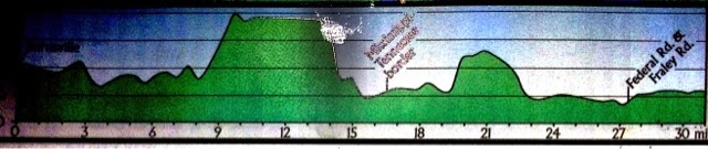
Route maps for today. Part 1:


Part 2 (My detour occurred miles 26-32):


Part 3:


The day started out sunny but quickly turned to clouds, which was a blessing for climbing all the steep hills. My detour took me through some rain and some hail, which the rest of the group missed. The rest of the group also missed the downpour I cycled through for the last few miles because they had already reached our destination by then--the Imperial Lodge in Waverly, TN. This is a great night to be in a motel because it's supposed to rain all night. (If any of my readers have been concerned about the tornado warnings that have been issued for this area, know that I've seen no sign of one yet and I'll be sleeping indoors tonight.) We also managed to get our laundry done here. 

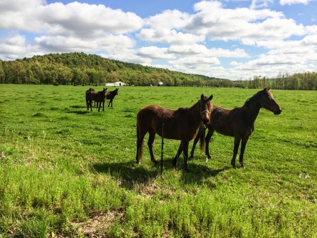
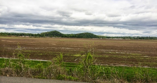
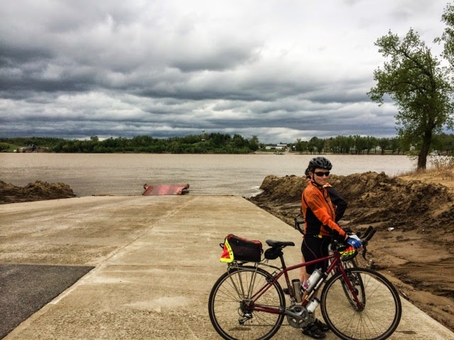
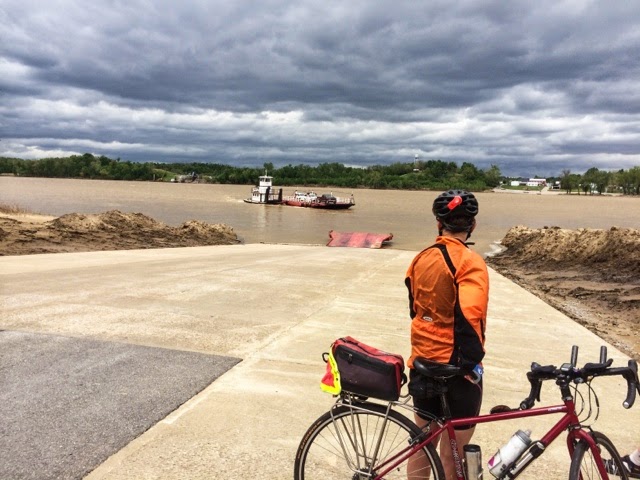
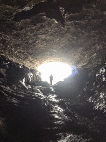
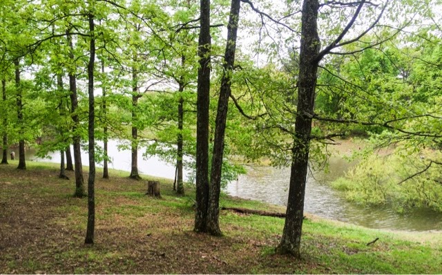
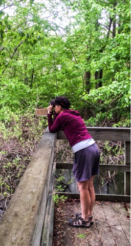
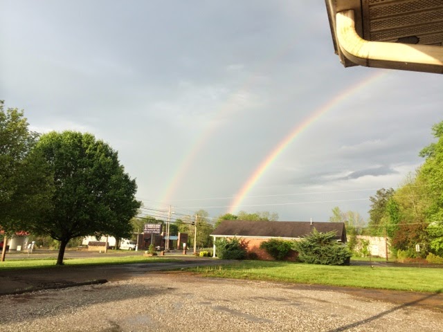
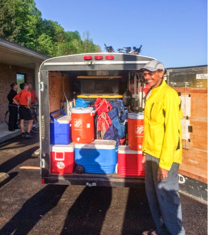
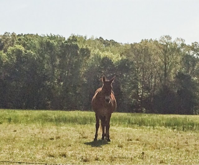
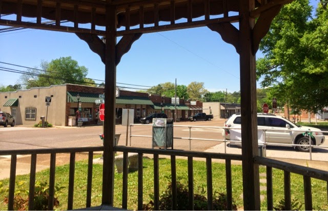
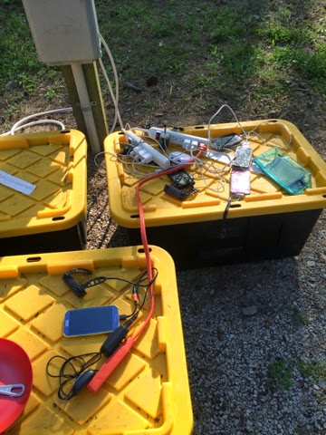
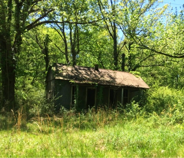
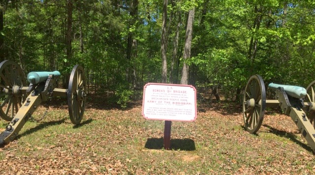
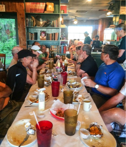
Photos from the day:

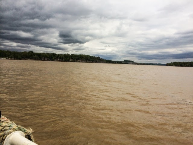
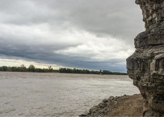
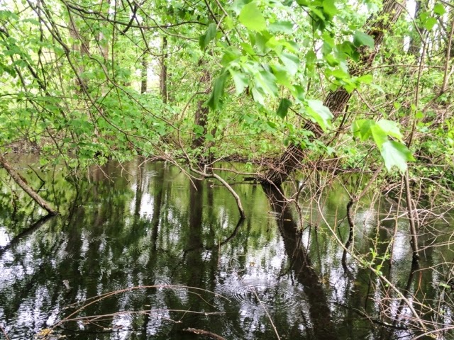
The Tennessee River. The River was on our left for much of the day, but there was so much foliage it didn't make for good photo opportunities. 


Other notable mentions: Property labeled "Shotgun Holler." Large homestead labeled "Rattlesnake Ranch." As I was once again chased down by many an unleashed/unfenced dog, I kept thinking the term "junkyard dog." One dog put his mouth on my heel today. When I felt fur and slobber (no teeth), I yelled, "Hey, what are you doing?!"

I'm feeling very discouraged tonight. Bound to happen, right? My feet and hands feel like they have nerve damage. We're having a huge thunderstorm at the moment, and the weather tomorrow (for our steepest, hilliest day yet) is supposed to be crappy and become "extreme" after 1:00. Even the group dynamics are getting on my nerves. Tonight after supper, we picked and packed our breakfasts and lunches for tomorrow. It was a free-for-all. I don't have the energy to get in the thick of the scrapping. I wish this trip had stronger leadership. 

I am grateful for an indoor bed tonight; you should hear the rain thundering down at the moment! Hopefully I'll recover some tonight and feel more upbeat tomorrow. 

Saturday, April 26, 2014

Pennyville, TN

I cycled 51 miles today (all on route, no wrong turns), with 2,431 feet of climbing. It was a sunny day, and got up to 85 degrees F. We are camping in a private campground called Beech Bend. 

Today's route, part 1:


Part 2:


Part 3:


Since our rough-weather start, we have been very lucky. We had a lot of rain two nights ago, but it started after we were in our tents and stopped before we got up. It has been much drier, not as humid, as I expected. I have been able to hand wash clothes when I get into camp and have them dry on a line before I crawl into the tent for the night. Today was the first day it started to feel too hot, but it was still okay in the shade. 

The hills have been tough since we crossed into Tennessee. It's not just the amount of climbing; it's the steepness of the hills. These hills climb steeply, and get steeper the closer you get to the top. Looks like we're really in for a challenge for at least the next week. 

Photos from today:


My view of downtown Decaturville, TN, as I rested and ate my lunch in a gazebo:


Another abandoned home I can envision as a nice homestead:


A typical charging mess at our campsite:


Friday, April 25, 2014

On to Tennessee!

Today I cycled 68 miles (with around 3,000 feet of climbing), but it should have been 55-59. Two of us took a wrong turn at the end of the day, ended up cycling part of tomorrow's route, and had to backtrack. Not fun, but it makes a good story, and us two bozos get to rib each other mercilessly. 6.5 hours on the road. 

Photos from along the way:


When I see cute, tiny abandoned places like this, I wonder who once lived there, and I fantasize about fixing the place up. 


No photo of crossing into Tennessee; there was no sign, just a change in the road surface. 

Steeper hills today; check it out:


And tons of dogs! I had to get off my bike twice to walk by nasty dogs. Also, a number of the dogs today were stealthy attackers. They would silently race toward me through soft grass just out of my peripheral vision and be upon my heels before I caught on. 

At the end of our ride today, I rode through Shiloh National Military Park. This is such an impressive and extensive memorial park! It encompasses many acres, and there are dozens (hundreds?) of plaques and memorials--many of them in the precise locations where different brigades were stationed or fought. It was here that the Confederates launched a preemptive strike against Union forces that were amassing for their strike on Corinth. Although there was a bloodbath here (23,746 killed, wounded, or missing), there was no decisive outcome. The place leaves a sobering impression of the scale of the battle and the numbers of soldiers involved. 


Instead of cooking tonight, we ate out at a locally famous place called Hagy's Catfish Hotel. I ate catfish for the first time; yummy!


Tonight we're camping in Shiloh Battlefield Campground with about 100 very LOUD Cub Scouts. It's definitely an earplug night!